Maps
|
Vacant Property Explorer
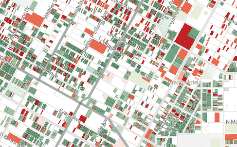
The Vacant Property Explorer is an online portal for viewing and exploring potentially vacant properties in the City of St. Louis. Data are collected from the publicly-available datasets of several City departments and presented with the following tools:
|
|
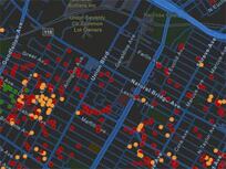
Building Demolitions
Find vacant building demolitions happening in the city of St Louis. All sites are color coded as either coming soon, in progress, or recently completed. |
|
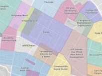
Neighborhoods
Find out what neighborhood you are in and if there's a local neighborhood association representing you and your fellow residents. If there is, find meeting times, locations, and contact information. |
Statistics
|
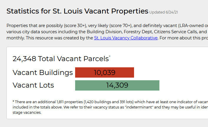
Vacancy in St Louis
Learn more about vacant property across the City and in specific neighborhoods. |